Plane surveying is the survey in which the earth surface is assumed to be plane and the curvature of the earth is ignored. The plane surveys extend only over small areas and the lines connecting any two points on the surface of the earth are treated as straight lines and the angles between such lines are taken as plane angles. In dealing with plane surveys, knowledge of plane geometry and trigonometry is required. Surveys covering an area up to 260 km² may be treated as plane surveys. It is to be noted that the difference in length between the arc and the subtended chord on the earth surface for a distance of 18.2 km is only 0.1 m.
Scope and Use of Plane Surveying
Plane surveys are carried out for engineering projects on sufficiently large scale to determine relative positions of individual features of the earth surface. Plane surveys are used for the layout of highways, railways, canals, fixing boundary pillars, construction of bridges, factories etc. The scope and use of plane surveys is very wide. For majority of engineering project, plane surveying is the first step to execute them. Plane surveys are basically needed for proper, economical and accurate planning of all engineering projects and their practical significance cannot be overestimated.
Division of Plane Surveying
Plane surveying can be divided in the following ways.
Chain Surveying
Chain surveying is the simplex type of surveying in which the area to be surveyed is divided in to a number of triangles.The length of the sides are measured and the interior details are recorded. The whole area is then plotted on a drawing sheet to a suitable scale to produce a map.
Traverse Surveying (compass and theodolite surveying)
Traverse surveying is a type of surveying in which the plot of land to be surveyed is enclosed by a series of straight lines making angles with one another. The length of the lines and the angles are measured and plotted with all interior details on a drawing sheet to a suitable scale to produce a map.
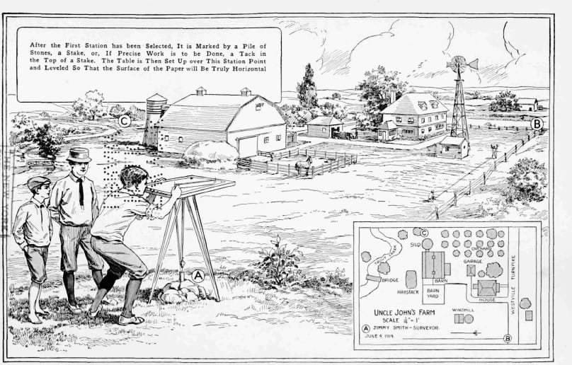
Plane Table Surveying
Plane table surveying is a method of surveying in which observations and plotting are done simultaneously.
Ordinary Leveling
It is a type of surveying in which the relative elevations of different points on the surface of the earth are determined.
I thank you for accept me.
a great site for civil engineers…this blog helped me a lot in understanding my subjects.. thanks for such a great blog…